This story starts with fishermen.
Off the coast of Peru and Ecuador, a warm ocean current shows up most years around Christmastime. Fish that thrive in the normally cold, nutrient-rich water there scatter or die off when the warm water arrives, so 19th-century fishermen used the slow season to repair nets and spend time with family. They called the current El Niño, Spanish for "the little boy," a reference to the Christ child, since it tended to peak right around the holiday.
For a hundred years after that, El Niño stayed a local story. Nobody had any reason to think a warm current off one stretch of South American coastline had anything to do with weather anywhere else. That assumption turned out to be spectacularly wrong.
Solving half the puzzle
The first real clue came from an unrelated disaster on the other side of the world.
After a catastrophic famine tied to a failed Indian monsoon in the late 1800s, the British government put mathematician Gilbert Walker in charge of figuring out how to predict monsoon failures before they happened.
Walker never solved that problem directly, but while digging through decades of pressure records across the Indo-Pacific region, he found something strange: air pressure over the eastern and western tropical Pacific rose and fell in a seesaw pattern, opposite each other, over periods of a few years. He called it the Southern Oscillation.
Walker had found a real, measurable pattern. What he could not explain was why it happened, or what it had to do with anything in the ocean. The mystery remained unsolved for another 40 years.
Connecting the dots
By the 1950s, researchers had noticed something curious: the same years when Walker's Southern Oscillation index dropped low were the years fishermen off Peru reported unusually warm water. Nobody could explain why an atmospheric pressure pattern and an ocean current thousands of miles apart would move together.
Jacob Bjerknes, a Norwegian meteorologist working at UCLA, finally connected the two. Walker's atmospheric seesaw and the fishermen's warm current were not separate phenomena. They were one coupled system: warm Pacific water weakens the trade winds, weaker trade winds let more warm water pile up, and the whole system feeds itself in a loop that can last a year or more.
Bjerknes named the atmospheric half of that loop the Walker Circulation, in honor of the man who found it decades earlier without knowing what it was. The combined phenomenon eventually got its own name: El Niño-Southern Oscillation, or ENSO.
Caught off-guard
In 1982, climate scientists gathered for a conference on El Niño. Their consensus at the time: no El Niño was underway that year. They were wrong.
One of the most powerful El Niños of the 20th century was forming as they met, obscured partly by a major volcanic eruption in Mexico that had scientists' attention pointed elsewhere. El Chichón erupted three times that spring, killed close to 2,000 people, and threw enormous volumes of sulfur dioxide and ash into the atmosphere. That plume did more than devastate the villages around it. It scrambled the era's satellite readings, masking the ocean warming that was already underway in the Pacific. The El Niño was not widely recognized until 1983, by which point it had already reshaped weather on nearly every continent.
The numbers, once scientists pieced them together after the fact, were staggering. Parts of Peru received 11 feet of rain in a stretch of coastline where 6 inches was normal, and some rivers there carried a thousand times their typical flow. The Peruvian anchovy fishery, one of the largest in the world and the same cold-water system the original fishermen had been describing a century earlier, collapsed almost entirely in 1983. On the other side of the Pacific, Australia and Indonesia were living through one of the worst droughts either country had seen. Total global damage came in above $8 billion, an enormous sum for a single weather pattern in 1982 dollars.
Researchers vowed to never be caught off-guard again. Within two years, NOAA had prototype ocean buoys in the water. Over the following decade, a multinational partnership spanning the US, Japan, France, Taiwan, and Korea deployed more than 400 buoys across 83 research cruises, building out what became the TAO array, a permanent chain of nearly 70 moored sensors strung across the tropical Pacific, each one constantly reporting sea surface temperature, subsurface temperature, and wind data back to shore. The full array was finished in December 1994. In 1997, with a new El Niño already forming, Congress made the funding permanent.
The investment paid off almost immediately. The event the TAO array was built to catch arrived within months of going fully operational, and this time, nobody missed it.
Breaking records
With real-time ocean data finally in place, the next two major events became the benchmark for everything since. This time the world watched them happen in real time instead of reconstructing them afterward.
The 1997 to 1998 El Niño peaked at 2.4 degrees Celsius above average on NOAA's Oceanic Niño Index, the standard measure of El Niño strength, and it left a mark that outlasted the event itself. Indonesia suffered one of its worst droughts on record, with uncontrolled fires that year burning through a cereal shortfall of more than 3.5 million metric tons. California, usually a beneficiary of a strong El Niño's wetter winters, got exactly that: one of its wettest rainy seasons on record, with the flooding to match.
In the United States alone, the event was tied to 189 deaths, many from the tornadoes that came with it. Globally, the death toll topped 22,000 and damages exceeded $36 billion. It stood as the strongest event on record for almost two decades, and it was the first El Niño the public actually experienced as a single, named, tracked global event rather than a string of unrelated disasters.
Then the 2015 to 2016 El Niño edged it out, peaking at 2.6 degrees Celsius, the highest value ever recorded on the index since tracking began in 1950. Forecasters nicknamed it the Godzilla El Niño, and it behaved like one: the most severe coral bleaching event on record hit the Great Barrier Reef, Indonesia again declared drought across most of its provinces, and Australia's fire season started weeks early. Oddly, Southern California, the region that had braced hardest for a repeat of 1997 to 1998's flooding, stayed largely dry instead, a reminder that even the strongest El Niño on record does not guarantee the same results twice. A third event, in 2023 to 2024, reached 2.06 degrees, the fifth-strongest on record.
Uncharted territory
NOAA classifies El Niño strength using that same Oceanic Niño Index: a rolling three-month average of sea surface temperature in the central Pacific. Weak events run 0.5 to 0.9 degrees Celsius above average. Moderate events run 1.0 to 1.4. Strong events run 1.5 to 1.9. Anything at 2.0 degrees or higher is classified very strong, a threshold only three events have ever crossed.
As of NOAA's most recent monthly update, Pacific sea surface temperatures in the benchmark Niño 3.4 region rose from 0.98 degrees Celsius in April through June to 1.55 degrees in June alone, moving from moderate territory toward strong in a matter of weeks. Forecast models now put the odds at 95% that this event reaches very strong intensity by October through December 2026, and NOAA calculates a 69% chance it exceeds every El Niño on record, which would mean surpassing 2015-16's mark of 2.6 degrees. Beneath the surface, Pacific waters are already showing localized temperature anomalies of about 10 degrees Celsius at depth, well ahead of when an event like this typically reaches its peak.
Nobody currently working in this field has professionally tracked an El Niño stronger than 2015-16. If the current forecast holds, we are all about to.
What this means for your home
Forecasters are pointing to an active southern storm track and a mixed bag of rain, sleet, and heavy wet snow for the Northeast this winter, with the heaviest uncertainty around exactly when and where the big storms land. The Midwest sits in more of a coin-flip zone, with potential for sudden snow squalls and sharp cold snaps layered on top of a milder overall pattern. None of that is a guarantee.
Even the strongest El Niños on record have delivered surprises, including the January 2016 blizzard that dropped close to 30 inches of snow on Baltimore and New York City during what was otherwise a mild El Niño winter.
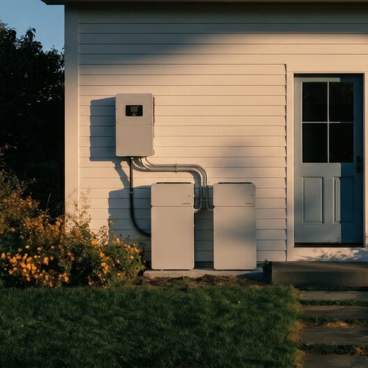
What is clear is that a strong El Niño winter can bring more volatile heating demand and a greater risk of storms that knock out power for days, not hours. The weather may be unpredictable. Your power does not have to be. A home battery keeps your home running when the grid goes down.
Systems Architect at Daylight. Sunnyside is Daylight’s guide to energy, the grid, and the weather that moves your bill.